

LandGlide: GPS Property Finder
Ever found yourself wandering through the countryside, curious about who owns that sprawling field or charming little house you just passed? Well, if you're like me and love a good mystery wrapped in a property line, then buckle up because LandGlide is here to satisfy all your boundary-hopping curiosities!
Unwrapping the Magic of LandGlide
Picture this: you're on a road trip, the sun is setting, and you're surrounded by miles of idyllic land. Suddenly, you wonder, "Who owns this piece of paradise?" Enter LandGlide, the GPS property finder app that's like having a real estate agent in your pocket. Available on both Android and iOS, this app serves up a rich tapestry of property details right on your screen.
Features That Make You Go "Wow!"
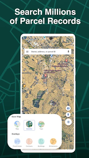
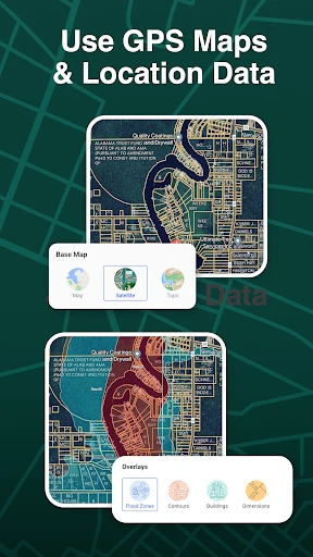
One of the coolest features of LandGlide is its ability to overlay property boundaries on a map using your device's GPS. As you move, LandGlide moves with you, updating the information in real-time. It's almost like magic, watching the lines pop up as you stroll or drive by.
Moreover, the app provides details like the property owner's name, the parcel number, and even the assessed value of the property. This can be a game-changer for real estate professionals or just curious explorers like myself who love knowing the lay of the land.
Why You’ll Love It
What I really appreciate about LandGlide is its user-friendly interface. Even if you're not a tech wizard, navigating through the app feels intuitive. The developers have clearly put a lot of thought into ensuring that users can access information with minimal hassle.
An added bonus is the offline mode. If you're venturing into an area with spotty internet service, no worries! You can download maps ahead of time and access all the juicy details offline.
A Few Things to Keep in Mind
While LandGlide is a fantastic tool, it’s worth noting that the app requires a subscription after a free trial period. This might not sit well with everyone, especially if you're just an occasional user. However, if you’re in the real estate business or frequently explore rural areas, it could be a worthy investment.
Another minor hiccup is that, depending on the area, some property data might not be as up-to-date as you'd hope. This isn’t a deal-breaker, but it’s something to be aware of if you're relying on it for critical decisions.
The Final Verdict
All in all, LandGlide is like having a secret key to unlock the mysteries of land ownership. It’s a nifty app that blends technology with curiosity in a way that’s both practical and fun. Whether you’re a real estate mogul in the making or just someone who’s always wondered “who owns that?”, LandGlide is worth checking out.
So, next time you’re out and about, give it a whirl. You might just find yourself hooked on the world of property discovery. Happy exploring!


- Developer
- Real Estate Portal USA
- Version
- 5.2.1
- Installs
- 1,000,000+
- Android Version
- 8.0
- Content Rating
- Everyone
- Price
- Free
- High accuracy in property boundary detection.
- User-friendly interface for easy navigation.
- Offline mode available for remote areas.
- Comprehensive property data included.
- Regular updates with new features.
- Requires subscription for full access.
- Limited features in free version.
- Battery drain due to GPS usage.
- May lag in densely populated areas.
- Dependent on mobile data for updates.


![Navigation [Huawei watches]](https://appnexuszone.com/wp-content/uploads/2025/11/image166304831526595115.webp)