

onX Backcountry Trail Maps GPS
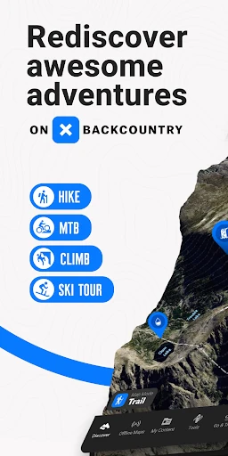
Discovering the Great Outdoors with onX Backcountry Trail Maps GPS
Hey there, fellow adventurers! If you're anything like me, the call of the wild is a siren song that can't be ignored. That's why I was psyched to try out the onX Backcountry Trail Maps GPS app. Now, I’ve always been a sucker for a good hike, and this app promised to be my new best friend in exploring the unbeaten paths. Let me take you through my experience with this nifty tool.
First Impressions: A User-Friendly Interface
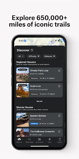
Right off the bat, I was impressed by the app's sleek and intuitive design. The user interface is clean, which means you spend less time fiddling with your phone and more time enjoying nature. It’s incredibly easy to navigate, even for those who might not be tech-savvy. The home screen displays various options like trails, weather updates, and saved maps, all at your fingertips.
One of the coolest features is the ability to download maps for offline use. This is a game-changer for those of us who love venturing into areas where cell service is as rare as a unicorn. No more panicking about losing your way when you’re miles deep in the wilderness!
Trail Exploration: More Than Just Maps
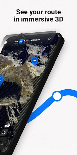
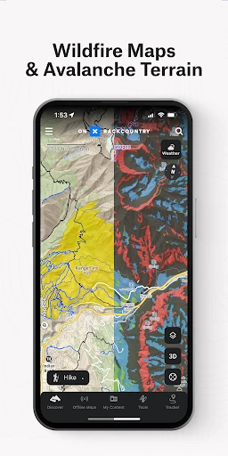
The app isn't just about showing you where to go; it’s about enhancing your entire outdoor experience. It offers detailed topographic maps that include information on terrain, vegetation, and even wildlife habitats. I mean, how cool is that? You can actually plan your hike based on what you want to see. Fancy a stroll through a lush forest or a climb up a rocky mountain? onX has got your back.
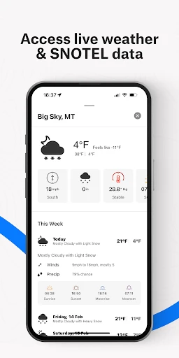
Another handy feature is the real-time weather updates. I can’t tell you how many times I’ve started a hike in sunny skies only to end up drenched in an unexpected downpour. With this app, you can check the weather right before you start your adventure and even while you’re on the trail. It’s like having a personal weatherman in your pocket!
Safety First: Navigation and Tracking
Safety is paramount when you’re out in the wild, and onX takes this seriously. The GPS tracking feature is spot-on, allowing you to keep tabs on your location at all times. It’s perfect for those solo hikes where you want a little extra peace of mind. Plus, you can share your live location with friends or family, so someone always knows where you are.
I also loved the track recording feature. It’s a fantastic way to document your hikes, keep track of your progress, and even brag a little about the killer trails you’ve conquered. Who doesn’t love a good humble brag now and then?
Final Thoughts: Is It Worth It?
So, is onX Backcountry Trail Maps GPS worth the download? Absolutely! Whether you’re a seasoned hiker or a newbie looking to dip your toes into the world of outdoor adventures, this app has something for everyone. It combines functionality with a user-friendly interface, making it a must-have for any outdoor enthusiast.
To wrap it up, if you’re looking to elevate your hiking game and explore the great outdoors with confidence, onX is a solid choice. Its comprehensive features ensure that you’re well-prepared for whatever Mother Nature throws your way. So, lace up those boots, grab your backpack, and let’s hit the trails with onX leading the way!
- Developer
- onXmaps
- Version
- 25.16.1
- Installs
- 500,000+
- Android Version
- 8.0
- Content Rating
- Everyone
- Price
- Free
- Detailed topographic maps available.
- Reliable GPS tracking in remote areas.
- Offline map access for no signal zones.
- Comprehensive trail information provided.
- User-friendly interface for easy navigation.
- High battery consumption.
- Limited free features.
- Occasional map loading delays.
- Subscription required for full access.
- Requires large storage space.